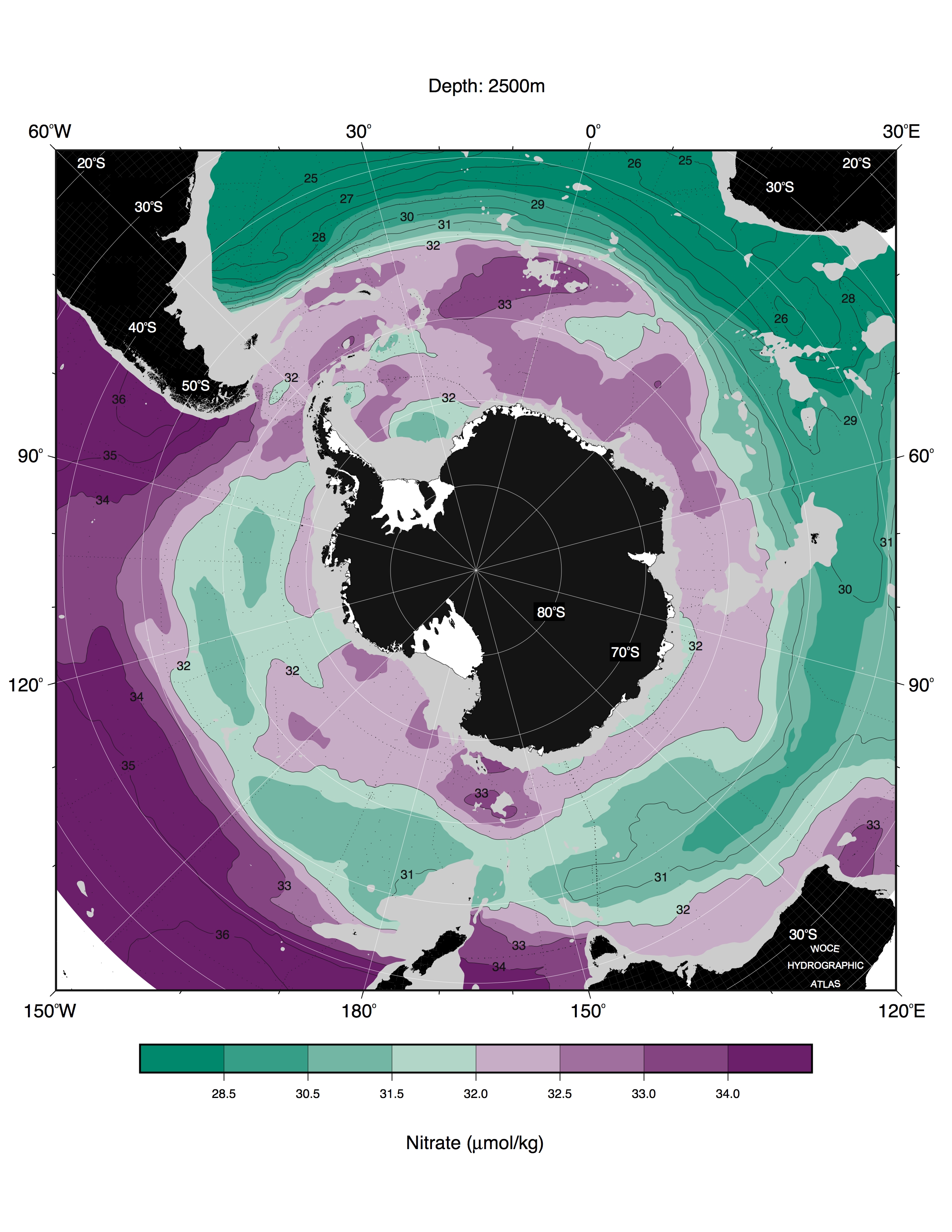
2500m LEVEL MAPS
click on thumbnails to view full-size jpg images
Θ
S
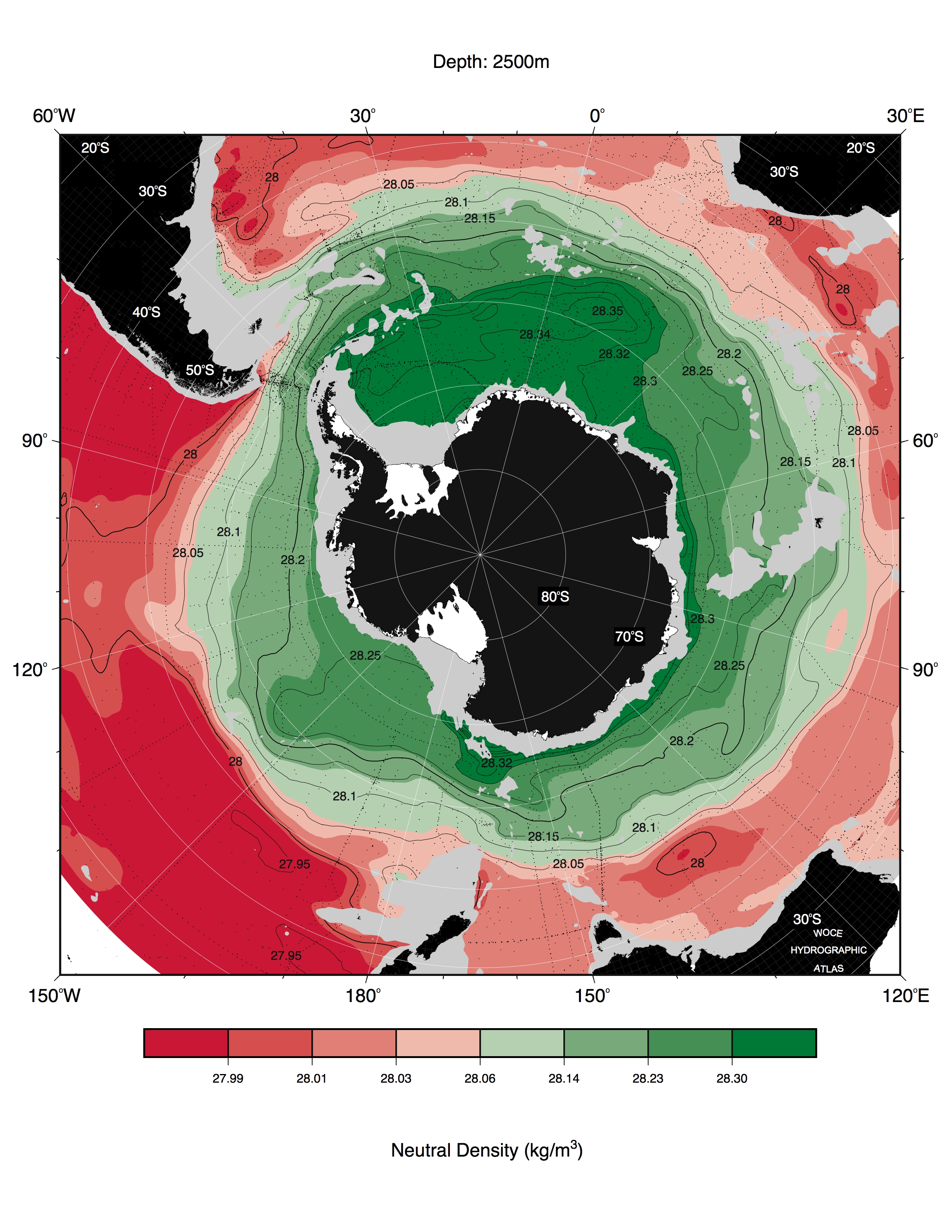
γ
n
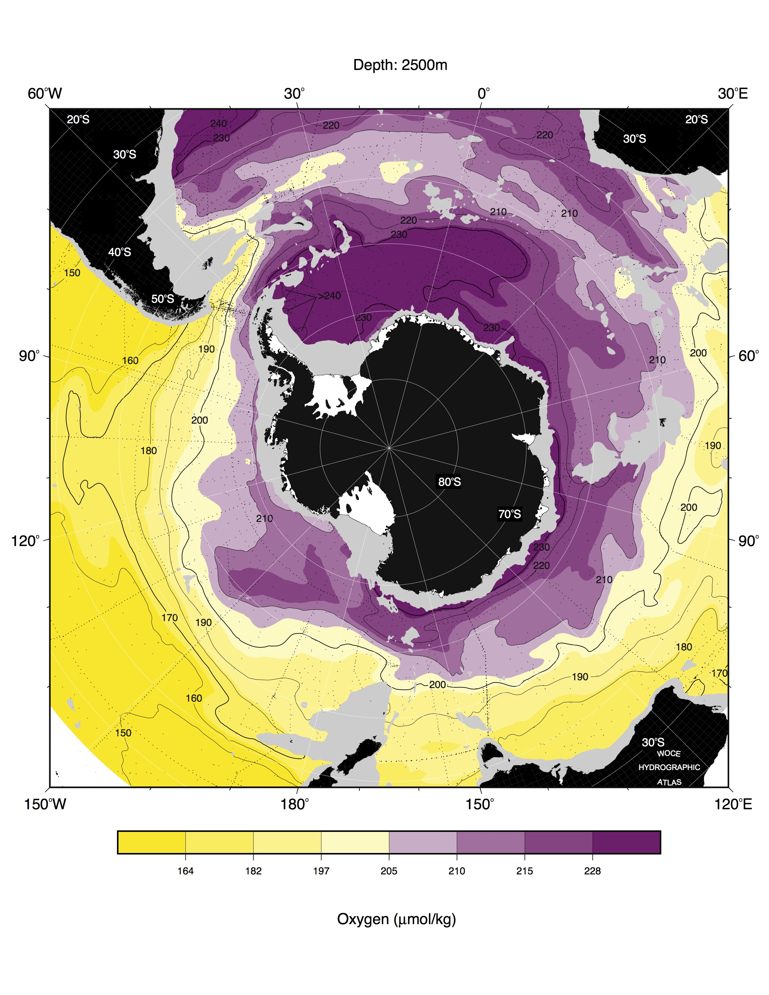
O
2
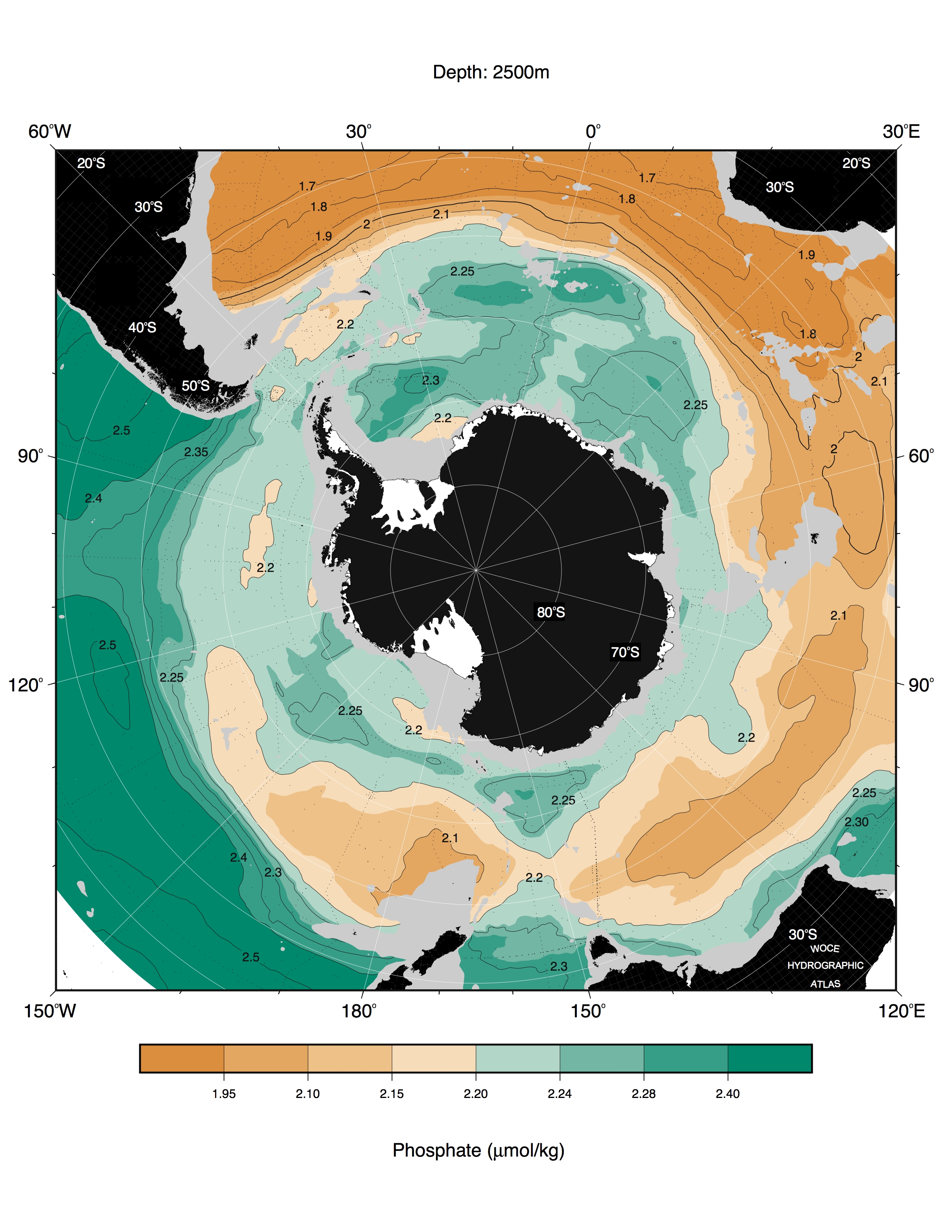
PO
4
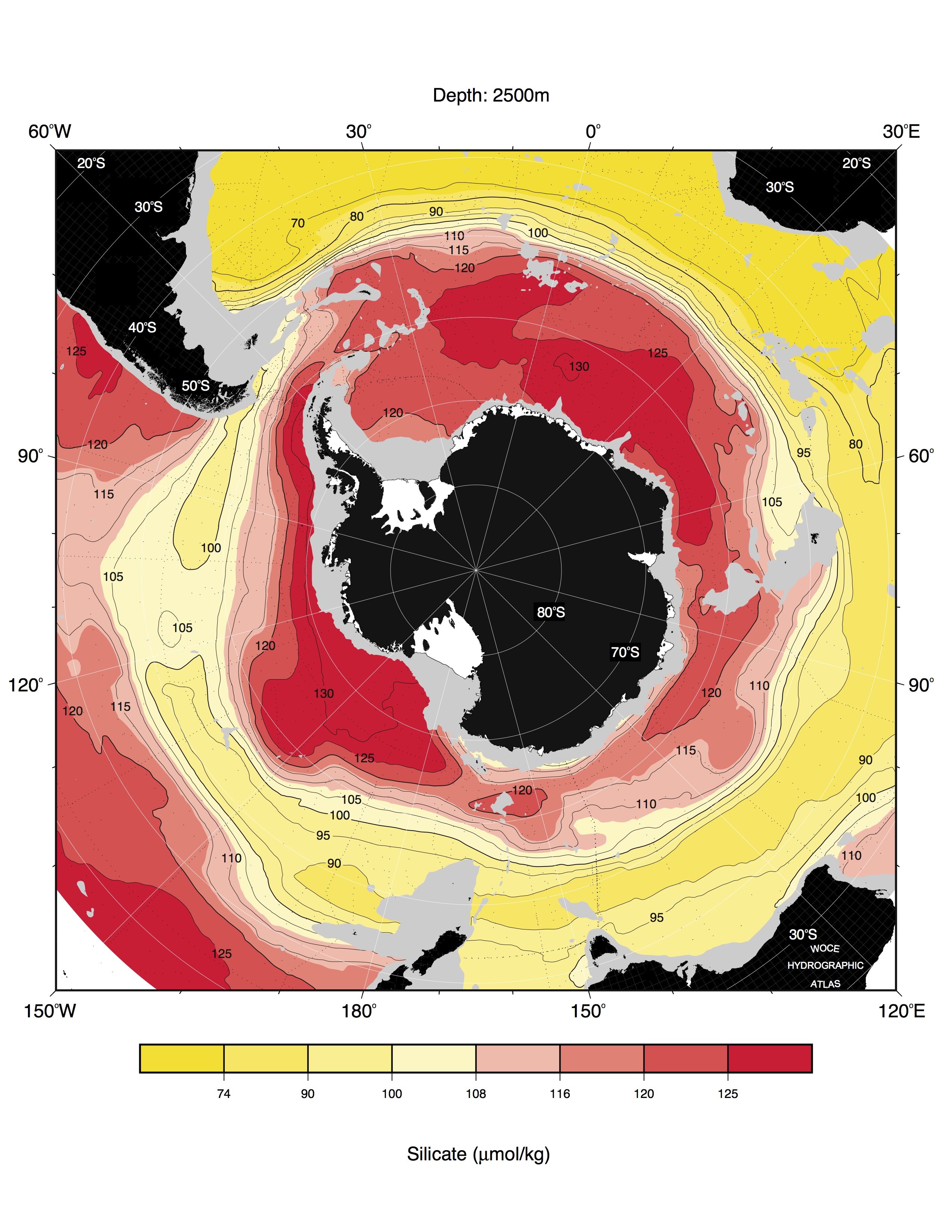
SIL
NO
3
Download all images on this page in
jpg
format and binary (netcdf) objectively mapped
data
on a 24-km (lon,lat) polar setereographic grid.